Buying a Waterfront Home: Shore, Moisture, Views and Operations
A buyer-focused waterfront home audit covering shoreline rights, flood evidence, slope and envelope condition, view resilience, access and a realistic operating plan.
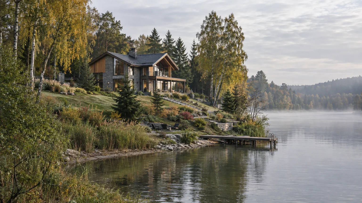
A waterfront house is often chosen emotionally before it is examined professionally. The view, a path to the shore and the apparent openness of the landscape can dominate a viewing. Yet “first line” establishes neither ownership of the bank nor lawful private access, slope stability, flood resilience or the condition of the building envelope. The buyer is acquiring a boundary system linking land, structure, water and public rules.
Place the waterfront review inside the broader country-home due-diligence process, but give separate instructions to the property lawyer, cadastral specialist, hydrology or geotechnical adviser and building surveyor. This guide is not a legal opinion or a flood-protection design. It defines the evidence a buyer should expect before treating a water view as a durable asset.
Map title, occupation and the actual shoreline
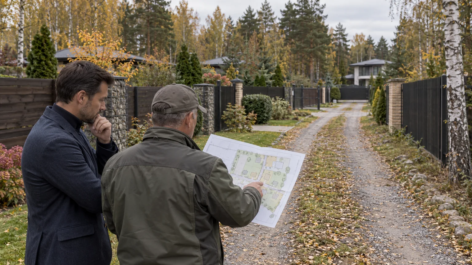
Start with the cadastral references for the plot and every registered structure. Obtain current registry information, boundary material and the documents behind the parcel geometry. Put the legal boundary, physical fence, shoreline, access road, paths, retaining works, drainage outlets, decks and waterside structures on one coordinated plan. Any mismatch between occupation and title needs a written explanation.
Russian water law distinguishes the water body, the public shore strip, the water-protection zone and the coastal protective strip. These are not interchangeable labels. A landscaped edge is not automatically private garden, and a fence is not proof that public movement can lawfully be excluded. The property-specific position must be confirmed against current records and competent legal interpretation rather than a generic distance quoted in marketing.
- identify every special-use zone crossing all or part of the plot;
- establish ownership of the land between the cadastral boundary and the water;
- verify the legal basis for steps, decks, retaining works, outlets and any mooring structure;
- record easements, public access and maintenance duties;
- separate an attractive physical arrangement from a legally transferable right.
Official spatial systems are useful navigation tools, not substitutes for a current extract, surveyed coordinates and professional advice. If the edge is unresolved, “private access to the water” should remain an unverified claim rather than part of the buyer's valuation.
Build a water-level and access history
A viewing records one water level on one day. Ask what happens during snowmelt, prolonged rain, unusual operating conditions on a managed water body and local drainage failure. Current flood and inundation zones may carry restrictions or engineering-protection requirements. Their presence and meaning must be checked in current official records for the exact property.
This enquiry is wider than groundwater alone. The plot drainage and seasonal-water assessment explains terrain, runoff and groundwater evidence. A waterfront site adds changing river or reservoir level, bank erosion, surcharge at an outlet, overtopping of low ground and the possibility that the access road fails before the house itself is affected.
- Collect event evidence. Request dated photographs, incident reports, insurance records and repair invoices after spring thaw and severe rain.
- Coordinate levels. Survey the shore, entrances, plant rooms, light wells, drive, electrical equipment and drainage control points to one datum.
- Trace every route. Show where rainfall and subsurface water originate, how they cross the site and what occurs when the normal outlet is unavailable.
- Test continuity. Review power loss, pump failure, blocked channels and emergency access without improvising unsafe tests.
The useful deliverable is a level and flow plan, an evidence-based event history, clearly stated uncertainty and maintainable responses. “It has never flooded” is not a technical record.
Read the bank, terraces and retaining works together
Walk from the house to the water and back. Look for cracking across paths, displaced joints, leaning fences or trees, bulging masonry, settlement steps, fresh fill, sediment loss, persistent wet patches and isolated new repairs. None proves instability by itself; a pattern tells the geotechnical adviser where to investigate.
Request design and as-built information for retaining walls, drainage layers, anchors, bank protection, stairs, decks and any waterside structure. Reconcile it with property boundaries and the physical construction. Establish how water behind a retaining element escapes, how the outlet can be inspected and whether machinery can reach the work area without destroying the garden.
- who owns each structure and carries the repair duty;
- which works were designed, approved and documented;
- whether buried drainage can be cleaned and its discharge point verified;
- whether landscaping diverts runoff toward the house or a neighbour;
- how erosion, root systems and past level changes are monitored;
- what evidence would trigger further survey or repair.
A buyer does not need a promise that the bank will never change. The objective is a competent baseline, an understanding of active mechanisms and a practical route to inspection, maintenance and repair.
Separate four moisture mechanisms in the building
Waterfront location is an easy but inadequate explanation for a damp mark. The survey must distinguish external liquid-water entry, capillary moisture, leaks from building services and condensation on cold assemblies. Each has a different test and remedy; treating all four with a dehumidifier can conceal evidence while leaving the source untouched.
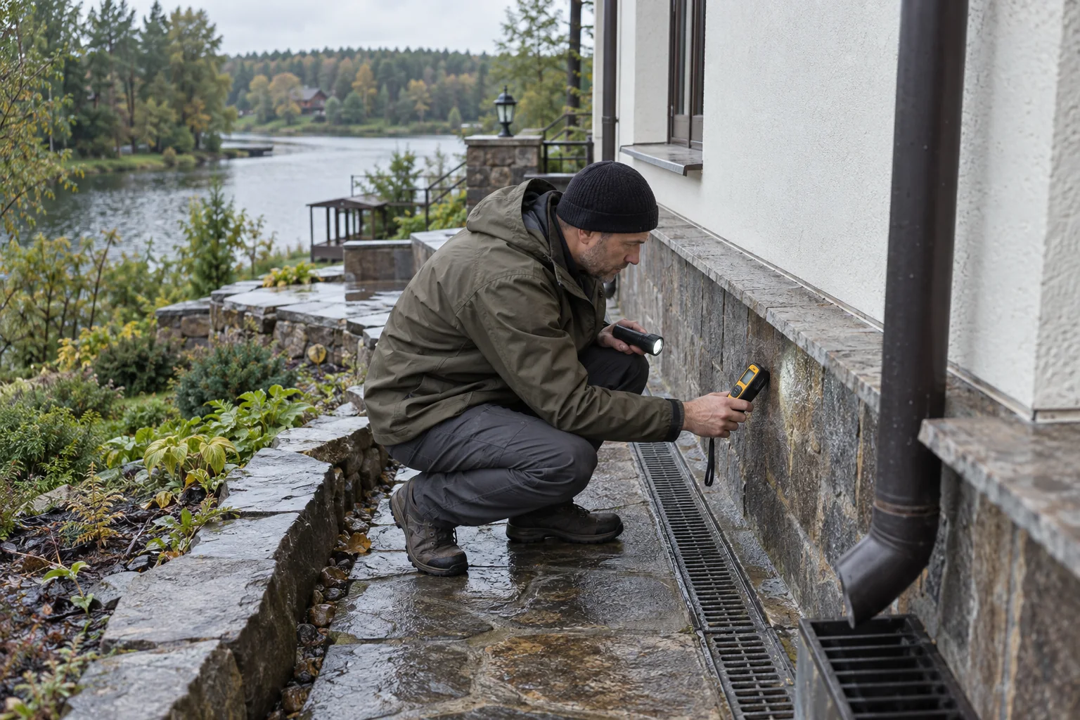
Inspect the lower envelope first: plinth, basement, service penetrations, light wells, movement joints, terrace interfaces and pipe routes. Continue through roof drainage, facade junctions, openings and balconies. Internally include corners of external walls, rooms behind fixed furniture, wardrobes, spa and utility areas and accessible concealed voids.
Instruments need context. Compare moisture readings on equivalent materials, use thermal imaging only under suitable environmental conditions and record indoor temperature and humidity across locations and operating modes. New paint, open windows or a dehumidifier running before the appointment can alter the snapshot. Repair history, repeat visits and control trends are therefore valuable.
Russia's current SP 50.13330.2024 addresses thermal performance for buildings with a maintained temperature and humidity regime and gives the responsible designer a current basis for envelope assessment. The US EPA moisture-control guide is neither Russian regulation nor flood guidance, but its diagnostic separation of liquid water, condensation and moisture-tolerant materials is a useful inspection discipline.
Test the environmental systems through the seasons
Open water does not set indoor humidity on its own. Airtightness, surface temperatures, ventilation, heating, occupancy, a pool or spa, laundry and user behaviour all contribute. Replace broad claims about a “damp river climate” with measured system performance.
Ask the engineer to record temperature and relative humidity across occupied and technical rooms, verify supply and extract operation, examine filters and heat exchangers, trace condensate drains and review controls. For a periodically occupied residence, test the strategy for low-temperature absence, winter arrival, rapid warm-up and recovery after loss of power.
- obtain trends rather than relying on a current display;
- look for condensation at glazing edges, reveals and thermal bridges;
- verify moisture removal from basement, laundry, spa and garage;
- confirm where condensate goes and how freezing is prevented;
- establish whether key components can be replaced without damaging finishes;
- define the safe unattended mode and alarm route.
Where decoration hides plant and access panels, follow the same method used for older services behind expensive finishes: records, service access and functional testing carry more weight than appearance.
Treat view, privacy and quiet as variable conditions
The listing photograph freezes one season and one hour. Summer foliage may provide privacy; winter exposes houses across the water. Evening light, weekend recreation, boats, anglers and a public path may change the experience. Visit in the morning, after dark and during a busy period. Open windows, stand on every terrace and walk every route that is lawfully available.
Review planning information for the opposite bank and adjacent land. Vacant ground can acquire a new use, vegetation can change and managed water levels can alter the visual shoreline. The method in the guide to checking future development beyond the fence should extend across the water, along access roads and to public recreational areas.
Privacy should come from siting, level changes, terrace depth, reflections, planting and controlled lighting—not from assuming a public bank can be closed. Check that cameras, floodlights and barriers do not create legal or neighbour conflict. A view supported by several landscape layers is usually more resilient than one narrow opening through vegetation outside the owner's control.
Verify every promised use of the water
Swimming, fishing, paddleboarding, boating, a beach and a private mooring are different propositions. Water quality changes, local restrictions can apply, and a structure at the edge needs a lawful basis, a safe design and continuing maintenance. A sales agent's demonstration is not evidence that the same activity transfers with the property.
List the household's intended uses. For each, record the access right, seasonal availability, safety controls, equipment storage, route from the house, lighting, supervision, insurance and operating responsibility. If the scenario depends on a club, management company or neighbouring parcel, obtain the current agreement and rules.
The waterfront property collection is a useful shortlist, but the catalogue attribute cannot certify the bank. Exact coordinates, title, access and real operating conditions still require property-specific review.
Construct an operating budget from assets and events
There is no universal maintenance premium for the first line. Cost depends on terrain, catchment, bank condition, foundation type, retaining structures, drainage, ventilation, equipment access and household use. Build the budget from systems rather than applying a percentage to the purchase price.
- Routine work: clear channels and outlets, test pumps and alarms, service gutters and ventilation, inspect the bank and external envelope.
- Seasonal work: prepare for snowmelt, maintain decks and terraces, winterise waterside equipment and inspect after significant rain or ice events.
- Planned renewal: pumps, sensors, drainage components, coatings, fixings, waterproofing interfaces and ventilation equipment.
- Event reserve: emergency attendance, pumping, controlled drying, temporary protection, access clearance and post-event survey.
- Capital projects: only after investigation and design—retaining repair, regrading, bank works or envelope remediation.
Collect invoices and service reports across several seasons, but do not project one historic total uncritically. Tariffs, contractors, occupancy and asset condition change. Every allowance should identify its source, frequency, scope and uncertainty.
Use a decision gate before deposit and handover
Arrange at least two visits in different conditions: the full technical inspection and a return after meaningful rain or during a more demanding season. If the relevant season is distant, record the resulting uncertainty in the report, price, contract conditions or decision to wait.
- title boundaries, occupation and shoreline are shown on one coordinated plan;
- public shore, water-protection and other special-zone issues have current documentary answers;
- high-water history and protective systems are supported by evidence;
- bank, retaining works, drainage and outlets are surveyed and maintainable;
- every moisture symptom has a mechanism, evidence and inspection limitation;
- ventilation and controls have been tested in normal and backup modes;
- view, noise, public access and future surroundings have been checked at different times;
- each waterside activity has a lawful basis, safe route and responsible operator;
- routine cost and capital exposure are separated;
- the transaction and handover records list structures, equipment, keys, settings, logs and unresolved matters.
When comparing homes in the country property catalogue, the strongest waterfront house is not necessarily the one closest to the water. It is the one with clear boundaries and rights, an observable bank and slope, controlled water routes, inspectable structures and a view that does not depend on permanent conflict with nature or neighbours. That is how the waterfront becomes a lasting living quality rather than a collection of hidden obligations.